
1955 Map of Artesia NE
USGS Topo · Published 1956About this map
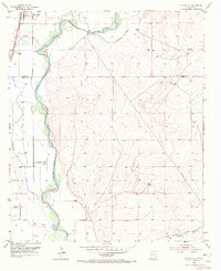
Lake Arthur anchors the northwest corner of this mid-century survey, situated at the boundary of Chaves Co and Eddy Co. The landscape is defined by the winding course of the Pecos River, which is flanked by a series of levees and ditches designed to manage the arid environment's water flow. To the west, the Atchison Topeka and Santa Fe railroad line runs parallel to the river, facilitating the transport of local resources. This era reflects an early industrial presence in the high plains, evidenced by an isolated Oil Well and Oil Tank located several miles east of the river valley. The eastern half of the map rises into the undulating terrain of Buffalo Valley, eventually reaching the southern Dog Canyon Draw. The confluence of Walnut Creek and Cottonwood Creek with the Pecos highlights the critical irrigation and drainage infrastructure established by the mid-1950s.
Find a feature on this map
11 named features on this map. Tap any name to fly to it.
Don’t see what you’re looking for? This feature index may not catch every label — zoom into the map to look around manually.
Map Details
Editions of this 1955 Artesia NE Map
3 editions found
Other maps of this area

1951 · Ninemile Well
USGS Topo · 1:24,000

1951 · Diamond Mound
USGS Topo · 1:24,000

1951 · Hagerman
USGS Topo · 1:24,000

1952 · Hagerman SW
USGS Topo · 1:24,000

1953 · Espuela
USGS Topo · 1:24,000

1954 · Carlsbad
USGS Topo · 1:250,000

1955 · Artesia
USGS Topo · 1:24,000

1955 · Spring Lake
USGS Topo · 1:24,000

1955 · Roswell
USGS Topo · 1:250,000

1955 · Red Lake
USGS Topo · 1:24,000