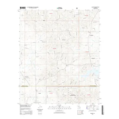
2015 Map of Ashland
USGS Topo · Published 2015About this map
Ashland sits at the southern edge of this 2015 survey, marking a transition between the settled parish lands and the sprawling timber of the Kisatchie National Forest. This section of Northern Louisiana is defined by a dense network of watercourses and small rural settlements, including Lucky, Old Saline, and New Ramah. The landscape is heavily influenced by the drainage patterns of Cypress Creek, Mill Creek, and Prothro Mill Creek, which wind through the terrain alongside historic local landmarks like Shell Hill. Genealogists and local historians can find specifically named sites such as Burt Cemetery near Lucky and Ramah Cemetery further south. The map reflects a rural economy rooted in land management, indicated by the detailed grid of parish roads and the presence of the Mill Creek Reservoir in the eastern portion of the quadrangle.
Find a feature on this map
106 named features on this map. Tap any name to fly to it.
Don’t see what you’re looking for? This feature index may not catch every label — zoom into the map to look around manually.
Map Details
Editions of this 2015 Ashland Map
This is the sole edition of this map. No revisions or reprints were ever made.
Other maps of this area

1947 · Goldonna
USGS Topo · 1:62,500

1947 · Ashland
USGS Topo · 1:62,500

1947 · Bienville
USGS Topo · 1:62,500

1948 · Jamestown
USGS Topo · 1:62,500

1949 · Jamestown
USGS Topo · 1:62,500

1949 · Bienville
USGS Topo · 1:62,500

1955 · Shreveport
USGS Topo · 1:250,000

1956 · Shreveport
USGS Topo · 1:250,000

1957 · Goldonna
USGS Topo · 1:62,500

1957 · Ashland
USGS Topo · 1:62,500