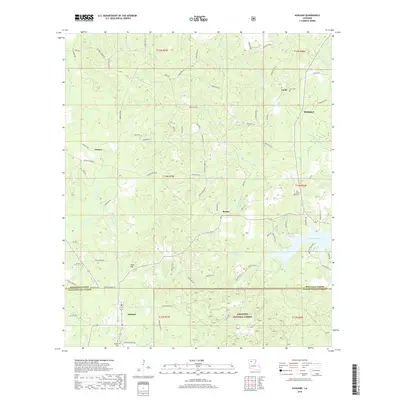
2018 Map of Ashland
USGS Topo · Published 2018About this map
Ashland anchors the southern boundary of this landscape where the borders of Natchitoches and Bienville Parishes meet. The area is defined by a dense network of timberlands and drainage systems, much of it contained within the Kisatchie National Forest. Small, scattered communities such as Lucky, Guynes, and Burkplace are connected by a web of parish roads and ridge-top routes like Ridge Rd.
Find a feature on this map
121 named features on this map. Tap any name to fly to it.
Don’t see what you’re looking for? This feature index may not catch every label — zoom into the map to look around manually.
Map Details
Editions of this 2018 Ashland Map
This is the sole edition of this map. No revisions or reprints were ever made.
Other maps of this area

1947 · Goldonna
USGS Topo · 1:62,500

1947 · Ashland
USGS Topo · 1:62,500

1947 · Bienville
USGS Topo · 1:62,500

1948 · Jamestown
USGS Topo · 1:62,500

1949 · Jamestown
USGS Topo · 1:62,500

1949 · Bienville
USGS Topo · 1:62,500

1955 · Shreveport
USGS Topo · 1:250,000

1956 · Shreveport
USGS Topo · 1:250,000

1957 · Goldonna
USGS Topo · 1:62,500

1957 · Ashland
USGS Topo · 1:62,500