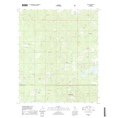
2020 Map of Ashland
USGS Topo · Published 2020About this map
Ashland anchors the southern portion of this region at the boundary of Bienville and Natchitoches Parish. The landscape is defined by the dense, winding drainage systems of North Louisiana, with dozens of small watercourses like Thresher Br and Topy Cr carving through the terrain. The southeastern corner is dominated by the Kisatchie National Forest, while the presence of the Mill Creek Reservoir indicates contemporary water management in an area once defined by historic mill sites, evidenced by names like Prothro Mill Cr and Blooms Mill Cr.
Find a feature on this map
98 named features on this map. Tap any name to fly to it.
Don’t see what you’re looking for? This feature index may not catch every label — zoom into the map to look around manually.
Map Details
Editions of this 2020 Ashland Map
This is the sole edition of this map. No revisions or reprints were ever made.
Other maps of this area

1947 · Goldonna
USGS Topo · 1:62,500

1947 · Ashland
USGS Topo · 1:62,500

1947 · Bienville
USGS Topo · 1:62,500

1948 · Jamestown
USGS Topo · 1:62,500

1949 · Jamestown
USGS Topo · 1:62,500

1949 · Bienville
USGS Topo · 1:62,500

1955 · Shreveport
USGS Topo · 1:250,000

1956 · Shreveport
USGS Topo · 1:250,000

1957 · Goldonna
USGS Topo · 1:62,500

1957 · Ashland
USGS Topo · 1:62,500