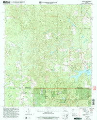
2003 Map of Ashland
USGS Topo · Published 2005About this map
Ashland sits at the southern edge of this survey, where the Bienville Parish and Natchitoches Parish line marks the boundary of the Kisatchie National Forest. This interior Louisiana landscape is defined by its drainage networks, with numerous waterways like Little Topy Creek, Sprawls Mill Creek, and Prothro Mill Creek cutting through the timberland. These names suggest an early era of local water-powered industry, although by the time of this revision, the land is characterized by forest management and scattered rural settlements such as Alberta and Brown.
Find a feature on this map
23 named features on this map. Tap any name to fly to it.
Don’t see what you’re looking for? This feature index may not catch every label — zoom into the map to look around manually.
Map Details
Editions of this 2003 Ashland Map
This is the sole edition of this map. No revisions or reprints were ever made.
Other maps of this area

1947 · Goldonna
USGS Topo · 1:62,500

1947 · Ashland
USGS Topo · 1:62,500

1947 · Bienville
USGS Topo · 1:62,500

1948 · Jamestown
USGS Topo · 1:62,500

1949 · Jamestown
USGS Topo · 1:62,500

1949 · Bienville
USGS Topo · 1:62,500

1955 · Shreveport
USGS Topo · 1:250,000

1956 · Shreveport
USGS Topo · 1:250,000

1957 · Goldonna
USGS Topo · 1:62,500

1957 · Ashland
USGS Topo · 1:62,500