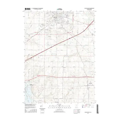
2016 Map of Ashland South
USGS Topo · Published 2016About this map
The city of Ashland and the Ashland University campus anchor the northern reaches of this landscape, where urban street grids transition into the rolling agricultural lands of southern Ashland County. The southern portion of the quadrangle is defined by a dense network of township and county roads connecting small communities such as Hayesville, Mifflin, and Widowville. This distribution of roads and settlements reflects a deeply established rural infrastructure, where family and community heritage is preserved in numerous scattered burial grounds, including the Sultzer, Ohl, and Vesper cemeteries.
Find a feature on this map
143 named features on this map. Tap any name to fly to it.
Don’t see what you’re looking for? This feature index may not catch every label — zoom into the map to look around manually.
Map Details
Editions of this 2016 Ashland South Map
This is the sole edition of this map. No revisions or reprints were ever made.
Other maps of this area

1906 · West Salem
USGS Topo · 1:62,500

1908 · Ashland
USGS Topo · 1:62,500

1908 · West Salem
USGS Topo · 1:62,500

1912 · Loudonville
USGS Topo · 1:62,500

1912 · Perrysville
USGS Topo · 1:62,500

1914 · Loudonville
USGS Topo · 1:62,500

1915 · Perrysville
USGS Topo · 1:62,500

1943 · Loudonville
USGS Topo · 1:62,500

1944 · Perrysville
USGS Topo · 1:62,500

1950 · Marion
USGS Topo · 1:250,000
Featured Places
- Ashland, OH
- Hayesville, OH
- Mifflin, OH
- South Peninsula Cottage Area, OH
- Carpenters Mobile Home Park, Ashland