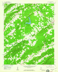
1958 Map of Ashville
USGS Topo · Published 1960About this map
Ashville serves as the focal point of this late-1950s study of St. Clair County, situated where the Dixie Highway intersects with the local water system. The landscape is defined by the parallel ridges of Big Ridge and Beaver Ridge, which channel the flow of Big Canoe Creek and its various tributaries. This era shows a community balancing rural traditions with mid-century development, evidenced by the lakeside residential layout at Pinedale Shores near Pinedale Lake.
Find a feature on this map
44 named features on this map. Tap any name to fly to it.
Don’t see what you’re looking for? This feature index may not catch every label — zoom into the map to look around manually.
Map Details
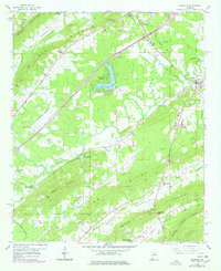
Editions of this 1958 Ashville Map
2 editions found
Other maps of this area

1889 · Springville
USGS Topo · 1:125,000

1892 · Springville
USGS Topo · 1:125,000

1947 · Cox Gap
USGS Topo · 1:24,000

1947 · Ragland
USGS Topo · 1:62,500

1947 · Ragland
USGS Topo · 1:24,000

1947 · Steele
USGS Topo · 1:24,000

1947 · Steele
USGS Topo · 1:62,500

1953 · Birmingham
USGS Topo · 1:250,000

1956 · Birmingham
USGS Topo · 1:250,000

1957 · Birmingham
USGS Topo · 1:250,000