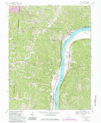
1968 Map of Athalia
USGS Topo · Published 1985About this map
The Ohio River valley serves as a bustling corridor of trade and transport in this 1968 study, where the Baltimore and Ohio railroad tracks follow the riverbank past riverside settlements like Athalia and Crown City. The landscape transitions from the river flats to the steep, wooded ridges of the Wayne National Forest, where smaller communities like Polkadotte and Platform are connected by winding routes like the Hannan Trace.
Find a feature on this map
55 named features on this map. Tap any name to fly to it.
Don’t see what you’re looking for? This feature index may not catch every label — zoom into the map to look around manually.
Map Details
Editions of this 1968 Athalia Map
4 editions found
Other maps of this area

1892 · Huntington
USGS Topo · 1:125,000

1898 · Huntington
USGS Topo · 1:125,000

1901 · Guyandot
USGS Topo · 1:62,500

1902 · Guyandot
USGS Topo · 1:62,500

1902 · Milton
USGS Topo · 1:62,500

1906 · Athalia
USGS Topo · 1:62,500

1906 · Glenwood
USGS Topo · 1:62,500

1908 · Athalia
USGS Topo · 1:62,500

1908 · Glenwood
USGS Topo · 1:62,500

1931 · Milton
USGS Topo · 1:62,500