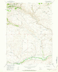
1953 Map of Atlantic City
USGS Topo · Published 1963About this map
Atlantic City serves as the focal point for this mid-century survey of the Wyoming gold mining district, where mining history and transcontinental migration patterns intersect. The landscape is marked by hard-rock operations such as the Tabor Grand Mine, Mary Ellen Mine, and St Louis Mines, located near Mill Hill and a Custom Mill. These industrial sites are juxtaposed with the deep ruts of the Oregon Trail and the South Pass Stage Road, which traverse the high desert terrain. To the south, the Sweetwater River winds past the Burnt Ranch (Historical) and the Burnt Ranch Historical Monument, indicating the location's significance as a way station. Along the creeks and gulches, individual family legacies are preserved through labels for the Hyde Homestead, Ober Homestead, and the S Lazy Y Ranch, providing a detailed look at the ranching and settlement patterns established after the peak of the gold rush.
Find a feature on this map
44 named features on this map. Tap any name to fly to it.
Don’t see what you’re looking for? This feature index may not catch every label — zoom into the map to look around manually.
Map Details
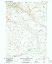
Editions of this 1953 Atlantic City Map
3 editions found
Other maps of this area

1953 · Gravel Spring
USGS Topo · 1:24,000

1953 · Radium Springs
USGS Topo · 1:24,000

1953 · Atlantic City
USGS Topo · 1:24,000

1953 · Louis Lake
USGS Topo · 1:24,000

1953 · South Pass City
USGS Topo · 1:24,000

1954 · Miners Delight
USGS Topo · 1:24,000

1955 · Lander
USGS Topo · 1:250,000

1958 · Lander
USGS Topo · 1:250,000

1958 · Circle Bar Lake
USGS Topo · 1:24,000

1958 · Dickie Springs
USGS Topo · 1:24,000