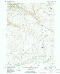
1953 Map of Atlantic City
USGS Topo · Published 1991About this map
Atlantic City sits at the heart of this mid-century survey, surrounded by the remnants of 19th-century gold mining and historic overland migration. To the west of the settlement, operations like the Tabor Grand Mine, St Louis Mines, and Mary Ellen Mine trace the mineral-rich veins of Rock Creek. The landscape is etched with the paths of earlier eras, most notably the Emigrant Trail and the South Pass Stage Road, which traverse the high plateau.
Find a feature on this map
34 named features on this map. Tap any name to fly to it.
Don’t see what you’re looking for? This feature index may not catch every label — zoom into the map to look around manually.
Map Details
Editions of this 1953 Atlantic City Map
3 editions found
Other maps of this area

1953 · Gravel Spring
USGS Topo · 1:24,000

1953 · Radium Springs
USGS Topo · 1:24,000

1953 · Atlantic City
USGS Topo · 1:24,000

1953 · Louis Lake
USGS Topo · 1:24,000

1953 · South Pass City
USGS Topo · 1:24,000

1954 · Miners Delight
USGS Topo · 1:24,000

1955 · Lander
USGS Topo · 1:250,000

1958 · Lander
USGS Topo · 1:250,000

1958 · Circle Bar Lake
USGS Topo · 1:24,000

1958 · Dickie Springs
USGS Topo · 1:24,000