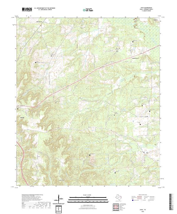
2022 Map of Atoy
USGS Topo · Published 2022About this map
The community of Atoy and the surrounding piney woods of Cherokee County are defined by a dense network of family cemeteries and small rural settlements. This landscape is shaped by the drainage systems of Horse Cr and Mule Cr, which flow toward the marshy expanse of the Rutherford Slough near Reklaw. The map reveals a deeply rooted rural society, where named landmarks are often burial grounds such as Walker Cem, Macedonia Cem, and Lowes Chapel Cem. These sites, along with the settlement at Shady Grove, point to a history of kinship and local community clusters that persist through the modern era. The southern portion of the quadrangle rises toward the elevation of Bradford Mtn, while a web of county roads and farm-to-market routes like FM 343 connect these isolated pockets of East Texas heritage.
Find a feature on this map
84 named features on this map. Tap any name to fly to it.
Don’t see what you’re looking for? This feature index may not catch every label — zoom into the map to look around manually.
Map Details
Editions of this 2022 Atoy Map
This is the sole edition of this map. No revisions or reprints were ever made.
Other maps of this area

1943 · Cushing
USGS Topo · 1:62,500

1943 · Rusk
USGS Topo · 1:62,500

1945 · Cushing
USGS Topo · 1:62,500

1945 · Rusk
USGS Topo · 1:62,500

1946 · Alto
USGS Topo · 1:62,500

1952 · Douglass
USGS Topo · 1:62,500

1953 · Palestine
USGS Topo · 1:250,000

1957 · Palestine
USGS Topo · 1:250,000
1973 · New Summerfield
USGS Topo · 1:24,000
1973 · Jacksonville East
USGS Topo · 1:24,000