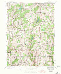
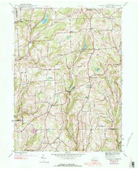
1945 Map of Auburn Center
USGS Topo · Published 1971About this map
Auburn Center and its surrounding hamlets occupy a landscape of creek-fed valleys and upland corners at the intersection of Susquehanna, Wyoming, and Bradford counties. This mid-century survey reveals a rural network defined by community focal points like Jersey Hill Ch and St Bonaventure Ch, alongside family-named landmarks such as Harris Corners and Carter Corners. The topography is shaped by the winding courses of Tuscarora Creek and Little Meshoppen Creek, with notable elevations like Round Top providing overlooks. Genealogists may find interest in the location of Boles Cem and the distribution of smaller settlements like Retta, Rushboro, and South Auburn. An Airway Beacon on the southern ridge reflects the technological era of the mid-1940s, while the persistence of upland bogs like Malone Swamp and Robert Swamp underscores the natural drainage patterns of this agricultural region.
Find a feature on this map
44 named features on this map. Tap any name to fly to it.
Don’t see what you’re looking for? This feature index may not catch every label — zoom into the map to look around manually.
Map Details
Editions of this 1945 Auburn Center Map
6 editions found
Other maps of this area

1943 · Montrose
USGS Topo · 1:62,500

1943 · Le Raysville
USGS Topo · 1:62,500

1945 · Montrose
USGS Topo · 1:62,500

1945 · Le Raysville
USGS Topo · 1:62,500

1945 · Meshoppen
USGS Topo · 1:62,500

1945 · Auburn Center
USGS Topo · 1:24,000

1945 · Jenningsville
USGS Topo · 1:24,000

1945 · Meshoppen
USGS Topo · 1:24,000

1945 · Laceyville
USGS Topo · 1:24,000

1946 · Tunkhannock
USGS Topo · 1:62,500
Featured Places
- Rush Township, PA
- Scranton Corners, Meshoppen Township
- Auburn Center, PA
- Stevens Township, PA
- Tuscarora Township, PA