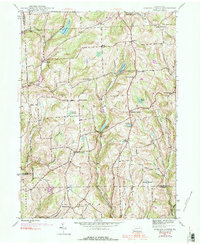
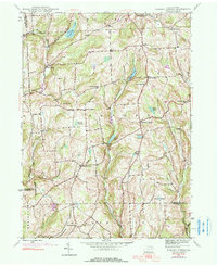
1945 Map of Auburn Center
USGS Topo · Published 1990About this map
Auburn Center and the surrounding rural uplands of Susquehanna County are defined by a network of small crossroad settlements and family-named corners. Established along the winding Little Meshoppen Creek, these communities supported a landscape of small farms and local institutions like Jersey Hill Ch and St Bonaventure Ch. The 1945 data, later updated with 1969 aerial photography, reveals the persistence of early landmarks such as Boles Cem and several distinct water bodies including Tuscarora Lake and White Pond. Along the southern edge, an Airway Beacon stands on the heights above Bunnell Hill Ch, illustrating the integration of early aviation infrastructure into the traditional agricultural terrain. The map captures a moment when the rural character of northern Pennsylvania remained largely intact, with numerous named settlements like West Auburn and South Auburn serving as central points for the remote farmsteads of the region.
Find a feature on this map
38 named features on this map. Tap any name to fly to it.
Don’t see what you’re looking for? This feature index may not catch every label — zoom into the map to look around manually.
Map Details
Editions of this 1945 Auburn Center Map
6 editions found
Other maps of this area

1943 · Montrose
USGS Topo · 1:62,500

1943 · Le Raysville
USGS Topo · 1:62,500

1945 · Montrose
USGS Topo · 1:62,500

1945 · Le Raysville
USGS Topo · 1:62,500

1945 · Meshoppen
USGS Topo · 1:62,500

1945 · Auburn Center
USGS Topo · 1:24,000

1945 · Jenningsville
USGS Topo · 1:24,000

1945 · Meshoppen
USGS Topo · 1:24,000

1945 · Laceyville
USGS Topo · 1:24,000

1946 · Tunkhannock
USGS Topo · 1:62,500
Featured Places
- Rush Township, PA
- Scranton Corners, Meshoppen Township
- Auburn Center, PA
- Stevens Township, PA
- Tuscarora Township, PA