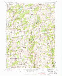
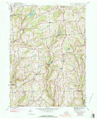
1945 Map of Auburn Center
USGS Topo · Published 1977About this map
Auburn Center serves as the focal point of a rural landscape spanning the intersection of Susquehanna, Bradford, and Wyoming Counties. Originally mapped in 1945 and updated with 1969 aerial photography, this map reveals a pattern of ridge-top settlements and crossroads like Angle Corners and Carter Corners. The region is defined by the steep drainage of Tuscarora Creek and Meshoppen Creek, where small ponds such as White Pond and Carlin Pond break the terrain. Local social and family history is preserved in landmarks such as the Jersey Hill Ch, St Bonaventure Ch, and Boles Cem. One of the more unique technological features is the Airway Beacon located on Bunnell Hill, signaling the transition into the mid-century era of regional navigation.
Find a feature on this map
43 named features on this map. Tap any name to fly to it.
Don’t see what you’re looking for? This feature index may not catch every label — zoom into the map to look around manually.
Map Details
Editions of this 1945 Auburn Center Map
6 editions found
Other maps of this area

1943 · Montrose
USGS Topo · 1:62,500

1943 · Le Raysville
USGS Topo · 1:62,500

1945 · Montrose
USGS Topo · 1:62,500

1945 · Le Raysville
USGS Topo · 1:62,500

1945 · Meshoppen
USGS Topo · 1:62,500

1945 · Auburn Center
USGS Topo · 1:24,000

1945 · Jenningsville
USGS Topo · 1:24,000

1945 · Meshoppen
USGS Topo · 1:24,000

1945 · Laceyville
USGS Topo · 1:24,000

1946 · Tunkhannock
USGS Topo · 1:62,500
Featured Places
- Rush Township, PA
- Scranton Corners, Meshoppen Township
- Auburn Center, PA
- Stevens Township, PA
- Tuscarora Township, PA