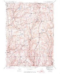
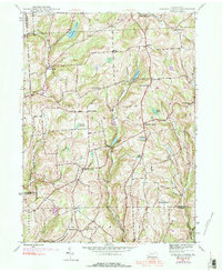
1945 Map of Auburn Center
USGS Topo · Published 1971About this map
The rolling highlands of Susquehanna County are defined here by a network of crossroads settlements and small headwater ponds. Auburn Center and West Auburn anchor a landscape of independent homesteads and family-named landmarks. The terrain is deeply etched by the Little Meshoppen Creek and its tributaries, which feed a series of upland waters including Tuscarora Lake, White Pond, and Lott Pond. Local social life in the mid-20th century centered on country parishes like Jersey Hill Ch and St Bonaventure Ch, while early aviation infrastructure appears at the Airway Beacon near the southern boundary. These 1945 records, updated with 1969 aerial data, trace the persistent rural character of the Auburn and Rush townships, showing the layout of farm-to-market roads before later development changed the character of these northeast Pennsylvania hills.
Find a feature on this map
42 named features on this map. Tap any name to fly to it.
Don’t see what you’re looking for? This feature index may not catch every label — zoom into the map to look around manually.
Map Details
Editions of this 1945 Auburn Center Map
6 editions found
Other maps of this area

1943 · Montrose
USGS Topo · 1:62,500

1943 · Le Raysville
USGS Topo · 1:62,500

1945 · Montrose
USGS Topo · 1:62,500

1945 · Le Raysville
USGS Topo · 1:62,500

1945 · Meshoppen
USGS Topo · 1:62,500

1945 · Auburn Center
USGS Topo · 1:24,000

1945 · Jenningsville
USGS Topo · 1:24,000

1945 · Meshoppen
USGS Topo · 1:24,000

1945 · Laceyville
USGS Topo · 1:24,000

1946 · Tunkhannock
USGS Topo · 1:62,500
Featured Places
- Rush Township, PA
- Scranton Corners, Meshoppen Township
- Auburn Center, PA
- Stevens Township, PA
- Tuscarora Township, PA