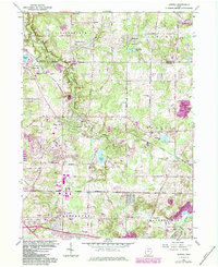
1962 Map of Aurora
USGS Topo · Published 1984About this map
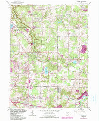
Aurora and its surrounding townships define the landscape of this 1962 survey, showcasing the post-war suburbanization and recreational development of Portage County. The map reveals a transition from traditional agriculture to community living, notably marked by the presence of a Mennonite church and several established cemeteries. The Conrail line bisects the territory, serving as a primary transit corridor alongside major thoroughfares like Aurora Road.
Find a feature on this map
41 named features on this map. Tap any name to fly to it.
Don’t see what you’re looking for? This feature index may not catch every label — zoom into the map to look around manually.
Map Details
Editions of this 1962 Aurora Map
5 editions found
Other maps of this area

1905 · Garrettsville
USGS Topo · 1:62,500

1906 · Kent
USGS Topo · 1:62,500

1906 · Chagrin Falls
USGS Topo · 1:62,500

1906 · Ravenna
USGS Topo · 1:62,500

1907 · Garrettsville
USGS Topo · 1:62,500

1908 · Chagrin Falls
USGS Topo · 1:62,500

1908 · Ravenna
USGS Topo · 1:62,500

1950 · Cleveland
USGS Topo · 1:250,000

1953 · South Russell
USGS Topo · 1:24,000

1953 · Aurora
USGS Topo · 1:24,000