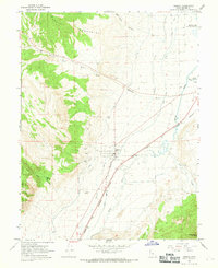
1966 Map of Aurora
USGS Topo · Published 1969About this map
The Sevier River flows through the heart of this Sevier County landscape, sustaining a complex network of irrigation infrastructure essential to the settlement at Aurora. This mid-century survey details the critical water management systems of the era, including the Piute Canal, Vermillion Canal, and Rocky Ford Canal, which snake across the valley floor. The eastern bank of the river is defined by the tracks of the Denver and Rio Grande Western railroad, while the western horizon is dominated by the steep slopes of the Valley Mountains and the Fishlake National Forest. Evidence of local industry is found in scattered Gravel Pits and various prospects near Lost Creek, while the northern reaches include Redmond Lake and the drainage of Denmark Wash.
Find a feature on this map
26 named features on this map. Tap any name to fly to it.
Don’t see what you’re looking for? This feature index may not catch every label — zoom into the map to look around manually.
Map Details
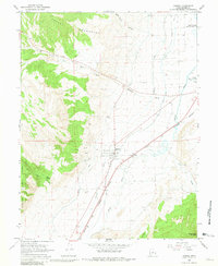
Editions of this 1966 Aurora Map
2 editions found
Other maps of this area

1885 · Manti
USGS Topo · 1:250,000

1885 · Beaver
USGS Topo · 1:250,000

1885 · Sevier Desert
USGS Topo · 1:250,000

1885 · Fish Lake
USGS Topo · 1:250,000

1895 · Manti
USGS Topo · 1:250,000

1896 · Fish Lake
USGS Topo · 1:250,000

1953 · Richfield
USGS Topo · 1:250,000

1953 · Delta
USGS Topo · 1:250,000

1956 · Salina
USGS Topo · 1:250,000

1956 · Price
USGS Topo · 1:250,000