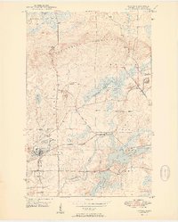
1950 Map of Aurora
USGS Topo · Published 1950About this map
Aurora and its surrounding iron-rich landscape on the Mesaba Range reflect the industrial vitality of northern Minnesota at the midpoint of the century. The map depicts a region defined by extensive mining operations, including the St James Pit, Miller Pit, and several Inactive Mines scattered across the terrain. An industrial Ore Processing Plant is positioned near the Embarrass River, while the Duluth Missabe and Iron Range railroad forms the primary logistical artery connecting these sites. The transition between the established town and the Superior National Forest Boundary highlights the balance between resource extraction and the wilderness. Settled points like Hinesdale, Colby, and Old Mesaba serve as vital markers of local history, while natural features like Colby Lake and Whitewater Lake break the industrial footprint.
Find a feature on this map
30 named features on this map. Tap any name to fly to it.
Don’t see what you’re looking for? This feature index may not catch every label — zoom into the map to look around manually.
Map Details
Editions of this 1950 Aurora Map
2 editions found
Other maps of this area

1949 · Aurora
USGS Topo · 1:24,000

1949 · Isaac Lake
USGS Topo · 1:24,000

1949 · Allen
USGS Topo · 1:24,000

1949 · Embarrass
USGS Topo · 1:24,000

1950 · Isaac Lake
USGS Topo · 1:24,000

1950 · Embarrass
USGS Topo · 1:24,000

1950 · Allen
USGS Topo · 1:24,000

1950 · Aurora
USGS Topo · 1:24,000

1950 · Biwabik
USGS Topo · 1:24,000

1950 · Biwabik NE
USGS Topo · 1:24,000