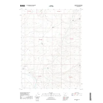
2017 Map of Austin Ranch
USGS Topo · Published 2017About this map
Austin Ranch sits as the primary human landmark in this section of Sweetwater County, overlooking a complex drainage network that defines the local geography. The southwestern corner is dominated by the Green River, which flows past Manns Flat and provides the low-lying relief for the surrounding high-desert terrain. Transportation in the area relies on historical routes like Old Stauffer Rd and county infrastructure such as Co RD 5, which traverse the open landscape.
Find a feature on this map
19 named features on this map. Tap any name to fly to it.
Don’t see what you’re looking for? This feature index may not catch every label — zoom into the map to look around manually.
Map Details
Editions of this 2017 Austin Ranch Map
This is the sole edition of this map. No revisions or reprints were ever made.
Other maps of this area

1954 · Rock Springs
USGS Topo · 1:250,000

1958 · Rock Springs
USGS Topo · 1:250,000

1961 · Scott Spring
USGS Topo · 1:24,000

1961 · Peru
USGS Topo · 1:24,000

1961 · Austin Ranch
USGS Topo · 1:24,000

1961 · Stevens Flat
USGS Topo · 1:24,000

1961 · Green River
USGS Topo · 1:24,000

1961 · Bryan
USGS Topo · 1:24,000

1962 · Rock Springs
USGS Topo · 1:250,000

1963 · Big Island Bridge
USGS Topo · 1:24,000