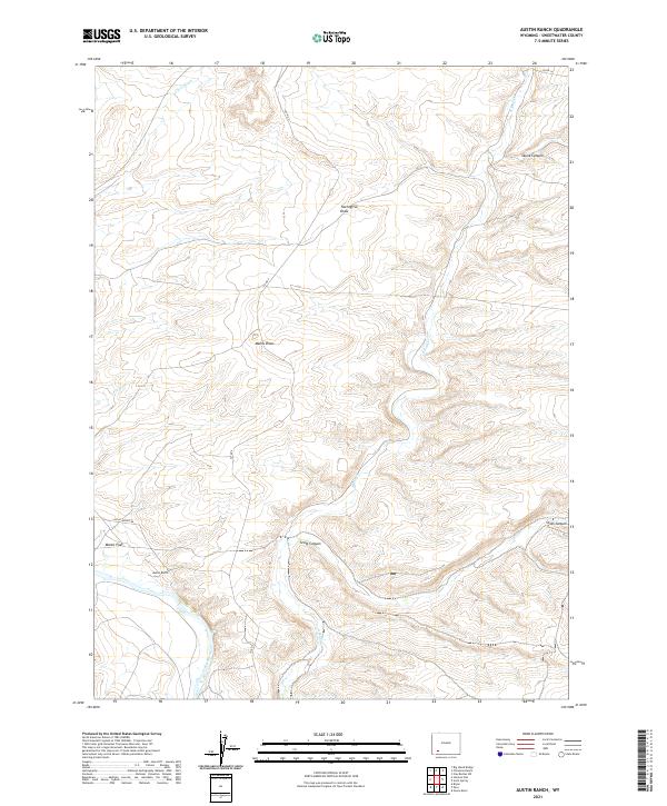
2021 Map of Austin Ranch
USGS Topo · Published 2021About this map
Austin Ranch serves as a primary point of human settlement in this arid reach of Sweetwater County, where the landscape is defined by an intricate network of intermittent watercourses and deep-cut terrain. The Green River flows through the southwestern corner, providing a vital water source for the surrounding high-desert environment. The topography is marked by significant drainages such as Twentyfive Draw, Manns Draw, and Chris Wash, which funnel seasonal runoff toward the river. Transportation in this part of the Wyoming backcountry relies on routes like Old Stauffer Rd and county roads that navigate the complex system of ridges and flats. Broad geological features like Manns Flat and Scott Canyon illustrate the erosive power of the elements over time, while the various township and range boundaries underscore the systematic grid of public land management in the American West.
Find a feature on this map
19 named features on this map. Tap any name to fly to it.
Don’t see what you’re looking for? This feature index may not catch every label — zoom into the map to look around manually.
Map Details
Editions of this 2021 Austin Ranch Map
This is the sole edition of this map. No revisions or reprints were ever made.
Other maps of this area

1954 · Rock Springs
USGS Topo · 1:250,000

1958 · Rock Springs
USGS Topo · 1:250,000

1961 · Scott Spring
USGS Topo · 1:24,000

1961 · Peru
USGS Topo · 1:24,000

1961 · Austin Ranch
USGS Topo · 1:24,000

1961 · Stevens Flat
USGS Topo · 1:24,000

1961 · Green River
USGS Topo · 1:24,000

1961 · Bryan
USGS Topo · 1:24,000

1962 · Rock Springs
USGS Topo · 1:250,000

1963 · Big Island Bridge
USGS Topo · 1:24,000