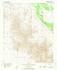
1957 Map of Avondale SE
USGS Topo · Published 1962About this map
The Sierra Estrella dominates this landscape south of the Gila River, where steep topography meets the wide expanse of Rainbow Valley. Published from a 1957 survey, this map captures the transition from the high peaks to the arid lowlands, marked by seasonal drainages like Corgett Wash. The northeastern portion is defined by the Gila River Indian Reservation Boundary, following the river's path where irrigation infrastructure is visible through the presence of a Ditch. Small-scale human activity is scattered throughout the region, including the settlement of Corgett and several Mines tucked into the mountain foothills. Movement across this desert terrain was limited to a few improved roads and a Jeep Trail winding through the reservation lands, reflecting the remote nature of Maricopa County during the mid-century.
Find a feature on this map
10 named features on this map. Tap any name to fly to it.
Don’t see what you’re looking for? This feature index may not catch every label — zoom into the map to look around manually.
Map Details
Editions of this 1957 Avondale SE Map
4 editions found
Other maps of this area

1912 · Phoenix
USGS Topo · 1:62,500

1913 · Maricopa
USGS Topo · 1:62,500

1914 · Phoenix
USGS Topo · 1:62,500

1915 · Maricopa
USGS Topo · 1:62,500

1946 · Avondale
USGS Topo · 1:62,500

1948 · Cashion
USGS Topo · 1:62,500

1951 · Mobile
USGS Topo · 1:62,500

1952 · Laveen
USGS Topo · 1:24,000

1952 · Montezuma Peak
USGS Topo · 1:24,000

1952 · Fowler
USGS Topo · 1:24,000