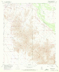
1957 Map of Avondale SE
USGS Topo · Published 1972About this map
The Sierra Estrella dominates this landscape, rising sharply from the desert floor to form a prominent topographic barrier between the Rainbow Valley and the Gila River basin. In the early 1970s, the northern edge of these Estrella Mountains transitioned from remote desert to recreational and sporting uses, notably with the establishment of the Phoenix International Raceway. The map documents the interface between the Estrella Mountain Regional Park and the Gila River Indian Reservation Boundary, tracing the natural course of the Gila River before significant modern channelization and suburban expansion reached this reach. Land surveyors and historians can trace the Gila and Salt River Meridian as it cuts through the mountains, while numerous Jeep Trails and a Pipe Line suggest early utility and exploration routes through Corgett Wash.
Find a feature on this map
14 named features on this map. Tap any name to fly to it.
Don’t see what you’re looking for? This feature index may not catch every label — zoom into the map to look around manually.
Map Details
Editions of this 1957 Avondale SE Map
4 editions found
Other maps of this area

1912 · Phoenix
USGS Topo · 1:62,500

1913 · Maricopa
USGS Topo · 1:62,500

1914 · Phoenix
USGS Topo · 1:62,500

1915 · Maricopa
USGS Topo · 1:62,500

1946 · Avondale
USGS Topo · 1:62,500

1948 · Cashion
USGS Topo · 1:62,500

1951 · Mobile
USGS Topo · 1:62,500

1952 · Laveen
USGS Topo · 1:24,000

1952 · Montezuma Peak
USGS Topo · 1:24,000

1952 · Fowler
USGS Topo · 1:24,000