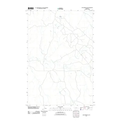
2011 Map of Ayer Spring NE
USGS Topo · Published 2011About this map
South Pine Oil Field dominates the northern reaches of this landscape, illustrating the industrial footprint on the rural Montana plains during the early twenty-first century. The terrain is defined by a dendritic drainage pattern where Cabin Creek and Horse Creek converge, creating a network of seasonal watercourses that include Cow Creek and Ash Creek. These waterways dictate the local geography, with roads like Cabin Creek Rd and Anticline Rd following the contours of the land. This survey provides a clear look at the intersection of energy extraction and the natural watershed, documenting the access routes and infrastructure required to maintain operations within the Cedar Creek drainage basin. The map captures a moment of modern land use where traditional ranching territory and resource development coexist across a vast, open topography.
Find a feature on this map
8 named features on this map. Tap any name to fly to it.
Don’t see what you’re looking for? This feature index may not catch every label — zoom into the map to look around manually.
Map Details
Editions of this 2011 Ayer Spring NE Map
This is the sole edition of this map. No revisions or reprints were ever made.
Other maps of this area

1953 · Miles City
USGS Topo · 1:250,000

1957 · Miles City
USGS Topo · 1:250,000

1958 · Miles City
USGS Topo · 1:250,000

1981 · Lawrence Creek East
USGS Topo · 1:24,000

1981 · Lawrence Creek West
USGS Topo · 1:24,000

1981 · Dorothy Draw
USGS Topo · 1:24,000

1981 · Ayer Spring NE
USGS Topo · 1:24,000

1981 · Ayer Spring
USGS Topo · 1:24,000

1981 · Rocking Chair Butte
USGS Topo · 1:24,000

1981 · Wibaux
USGS Topo · 1:100,000