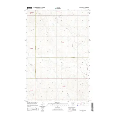
2014 Map of Ayer Spring NE
USGS Topo · Published 2014About this map
The South Pine Oil Field anchors the northern reaches of this landscape, situated where the borders of Prairie, Wibaux, and Fallon Counties converge. This 2014 survey reveals an industrial infrastructure superimposed over a network of natural drainage, where Anticline Rd follows the high ground between winding watercourses. Significant drainages including Cabin Cr, Horse Cr, and Cedar Cr carve through the terrain, dictating the placement of primitive transit routes like Coal Springs Trl and the Cabin Creek Loop. The map provides a clear look at the intersection of energy extraction and cattle country, showing how local access roads like Shortcut Rd and Cabin Creek Rd navigate the township and range system near the tri-county junction.
Find a feature on this map
20 named features on this map. Tap any name to fly to it.
Don’t see what you’re looking for? This feature index may not catch every label — zoom into the map to look around manually.
Map Details
Editions of this 2014 Ayer Spring NE Map
This is the sole edition of this map. No revisions or reprints were ever made.
Other maps of this area

1953 · Miles City
USGS Topo · 1:250,000

1957 · Miles City
USGS Topo · 1:250,000

1958 · Miles City
USGS Topo · 1:250,000

1981 · Lawrence Creek East
USGS Topo · 1:24,000

1981 · Lawrence Creek West
USGS Topo · 1:24,000

1981 · Dorothy Draw
USGS Topo · 1:24,000

1981 · Ayer Spring NE
USGS Topo · 1:24,000

1981 · Ayer Spring
USGS Topo · 1:24,000

1981 · Rocking Chair Butte
USGS Topo · 1:24,000

1981 · Wibaux
USGS Topo · 1:100,000