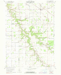
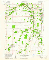
1960 Map of Ayersville
USGS Topo · Published 1990About this map
The confluence of North Powell Creek and South Powell Creek forms a prominent natural artery through this portion of Ohio, where small agrarian settlements and family landmarks define the landscape. The community of Ayersville sits at a significant crossroads in the northeast, while the hamlet of Arthur and the rail-stop at Rice anchor the western and southern reaches. Local genealogy is well-preserved through numerous burial grounds like Taylor Cem and Ice Cem, alongside several country houses of worship including Beulah Ch and Highland Ch.
Find a feature on this map
47 named features on this map. Tap any name to fly to it.
Don’t see what you’re looking for? This feature index may not catch every label — zoom into the map to look around manually.
Map Details
Editions of this 1960 Ayersville Map
4 editions found
Other maps of this area

1907 · Defiance
USGS Topo · 1:62,500

1908 · Ottawa
USGS Topo · 1:62,500

1908 · Napoleon
USGS Topo · 1:62,500

1909 · Defiance
USGS Topo · 1:62,500

1909 · Continental
USGS Topo · 1:62,500

1953 · Fort Wayne
USGS Topo · 1:250,000

1956 · Fort Wayne
USGS Topo · 1:250,000

1959 · Defiance East
USGS Topo · 1:24,000

1959 · Florida
USGS Topo · 1:24,000
1960 · Oakwood
USGS Topo · 1:24,000