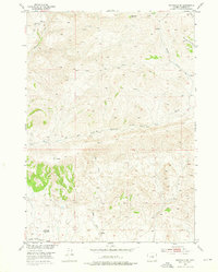
1952 Map of Badwater SE
USGS Topo · Published 1976About this map
Lichty Cabin and other isolated outposts define the human footprint in this high-desert ranching landscape of Natrona County. Mapped in the early 1950s, the terrain is dominated by the complex drainage systems of Badwater Creek and its seasonal tributaries, including Dry Fork Badwater Creek and Red Creek. The map documents a period when former residences like the Hitchcock Homestead and Red Ranch had already transitioned to abandoned status, illustrating the challenging nature of sustaining permanent settlements in this arid environment. Transportation is limited to a network of primitive routes, notably the Lost Cabin Arminto Road and various jeep trails that navigate the high points, such as the prominent VABM 7477 Badwater. This survey provides essential detail for those tracing family ties to the remote ranches and homesteads that once dotted the Wyoming interior.
Find a feature on this map
19 named features on this map. Tap any name to fly to it.
Don’t see what you’re looking for? This feature index may not catch every label — zoom into the map to look around manually.
Map Details
Editions of this 1952 Badwater SE Map
3 editions found
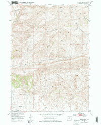
Other maps of this area

1952 · Deadman Butte
USGS Topo · 1:24,000

1952 · Badwater
USGS Topo · 1:24,000

1952 · Grave Spring
USGS Topo · 1:24,000

1952 · Arminto
USGS Topo · 1:24,000

1952 · Arminto NW
USGS Topo · 1:24,000

1952 · Waltman NW
USGS Topo · 1:24,000

1952 · Sioux Pass
USGS Topo · 1:24,000

1952 · Badwater NE
USGS Topo · 1:24,000

1952 · Badwater SE
USGS Topo · 1:24,000

1955 · Arminto
USGS Topo · 1:250,000