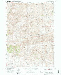
1952 Map of Badwater SE
USGS Topo · Published 1976About this map
Lichty Cabin and other remote outposts sit isolated among the high ridges of Natrona County, recorded here during a 1952 field check. This portion of the Missouri River Basin development program reveals a landscape defined by seasonal water and early cattle ranching infrastructure, including several corrals and numerous springs. Evidence of early settlement is marked by sites such as the Hitchcock Homestead and Red Ranch, both noted as abandoned by the mid-20th century. The drainage network is dominated by Badwater Creek and the Dry Fork, which carve through the high-elevation terrain. Transportation in this high desert environment is limited to the Bighorn Trail and various jeep trails, which provided the only access for surveyors and ranchers before the expansion of more modern road networks.
Find a feature on this map
18 named features on this map. Tap any name to fly to it.
Don’t see what you’re looking for? This feature index may not catch every label — zoom into the map to look around manually.
Map Details
Editions of this 1952 Badwater SE Map
3 editions found
Other maps of this area

1952 · Deadman Butte
USGS Topo · 1:24,000

1952 · Badwater
USGS Topo · 1:24,000

1952 · Grave Spring
USGS Topo · 1:24,000

1952 · Arminto
USGS Topo · 1:24,000

1952 · Arminto NW
USGS Topo · 1:24,000

1952 · Waltman NW
USGS Topo · 1:24,000

1952 · Sioux Pass
USGS Topo · 1:24,000

1952 · Badwater NE
USGS Topo · 1:24,000

1952 · Badwater SE
USGS Topo · 1:24,000

1955 · Arminto
USGS Topo · 1:250,000