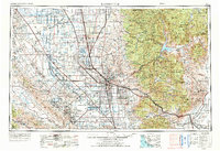
1962 Map of Bakersfield
USGS Topo · Published 1973About this map
The Southern San Joaquin Valley transitions from industrial oilfields and agricultural grids into the high peaks of the Sierra Nevada and Tehachapi Mountains in this early 1970s revision. The city of Bakersfield serves as the regional hub, surrounded by critical infrastructure like Meadows Field and Bakersfield College. The landscape is defined by the massive extraction operations of the Kern River Oil Field and the Midway-Sunset Oil Field, alongside an extensive water management network including the California Aqueduct and Kern River Flood Canal.
Find a feature on this map
148 named features on this map. Tap any name to fly to it.
Don’t see what you’re looking for? This feature index may not catch every label — zoom into the map to look around manually.
Map Details
Editions of this 1962 Bakersfield Map
4 editions found
Other maps of this area

1902 · Santa Ynez
USGS Topo · 1:125,000

1903 · Mt. Pinos
USGS Topo · 1:125,000

1903 · Tejon
USGS Topo · 1:125,000

1904 · Kaweah
USGS Topo · 1:125,000

1905 · Santa Ynez
USGS Topo · 1:125,000

1905 · Lompoc
USGS Topo · 1:125,000

1905 · Olancha
USGS Topo · 1:125,000

1905 · Fairview
USGS Topo · 1:24,000

1906 · Bakersfield
USGS Topo · 1:62,500

1906 · Kernville
USGS Topo · 1:125,000