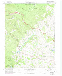
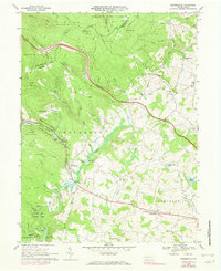
1967 Map of Bakersville
USGS Topo · Published 1973About this map
Laurel Hill and the high ridges of the Allegheny Plateau define this portion of Somerset County, where the Pennsylvania Turnpike Toll Road snakes through the valleys of Clear Run and Crab Run. Small agricultural and residential clusters like Bakersville, Lavansville, and Indiantown are scattered along the secondary routes, many centered around local congregations such as Bethany Ch and Salem Ch. The map illustrates a landscape transitioning into a recreational hub during the late 1960s and early 1970s, featuring the Plateau De Mount Ski Area and the conserved lands of Kooser State Park and Laurel Hill State Park. Industrial history is visible in the north near Roytown, where an Old Railroad Grade and a Strip Mine mark the legacy of resource extraction alongside the headwaters of Quemahoning Creek.
Find a feature on this map
62 named features on this map. Tap any name to fly to it.
Don’t see what you’re looking for? This feature index may not catch every label — zoom into the map to look around manually.
Map Details
Editions of this 1967 Bakersville Map
5 editions found
Other maps of this area

1913 · Somerset
USGS Topo · 1:62,500

1915 · Somerset
USGS Topo · 1:62,500

1921 · Meyersdale
USGS Topo · 1:62,500

1922 · Confluence
USGS Topo · 1:62,500

1922 · Donegal
USGS Topo · 1:62,500

1931 · Confluence
USGS Topo · 1:62,500

1933 · Confluence
USGS Topo · 1:62,500

1935 · Donegal
USGS Topo · 1:62,500

1939 · Meyersdale
USGS Topo · 1:62,500

1944 · Somerset
USGS Topo · 1:62,500
Featured Places
- Somerset Township, PA
- Milford Township, PA
- Lincoln Township, PA
- Middlecreek Township, PA
- Allenvale, Jefferson Township