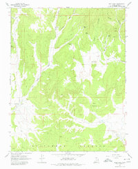
1966 Map of Bald Knoll
USGS Topo · Published 1980About this map
Skutumpah Terrace dominates the southern portion of this mid-1960s survey, illustrating a rugged landscape shaped by drainage systems like Kanab Creek and Sink Valley Wash. The map reveals a land utilized primarily for its natural resources and livestock range, evidenced by the central placement of Ford Pasture and the presence of scattered Mines and a Borrow Pit. The hydrology of the area is particularly detailed, tracing numerous water sources such as Spaniard Spring, Fisher Spring, and Elbo Spring which sustain life in these arid basins. To the east, the distinct volcanic profile of Bald Knoll rises above the surrounding canyons. A network of Jeep Trails provides the primary means of navigating between these remote landmarks, highlighting the primitive transportation infrastructure that defined this part of Kane County during the era.
Find a feature on this map
24 named features on this map. Tap any name to fly to it.
Don’t see what you’re looking for? This feature index may not catch every label — zoom into the map to look around manually.
Map Details
Editions of this 1966 Bald Knoll Map
2 editions found
Other maps of this area

1886 · Kanab
USGS Topo · 1:250,000

1953 · Cedar City
USGS Topo · 1:250,000

1954 · Johnson NE
USGS Topo · 1:24,000

1954 · Johnson
USGS Topo · 1:62,500

1957 · Kanab
USGS Topo · 1:62,500

1958 · Cedar City
USGS Topo · 1:250,000

1958 · Orderville
USGS Topo · 1:62,500

1962 · Cedar City
USGS Topo · 1:250,000

1966 · Alton
USGS Topo · 1:24,000

1966 · Bald Knoll
USGS Topo · 1:24,000