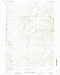
1955 Map of Baldy Mountain
USGS Topo · Published 1982About this map
Greaser Ranch sits at the heart of this high-elevation landscape within the Laramie Mountains, where the drainage patterns of the eastern Rockies are clearly defined. The terrain is a complex network of seasonal and perennial waterways, including the headwaters of Middle Sybille Creek and Strong Creek. To the west, the prominent peak of Baldy Mountain overlooks the surrounding ridges, while the distinct geological formation known as The Buttes rises between the creek beds.
Find a feature on this map
14 named features on this map. Tap any name to fly to it.
Don’t see what you’re looking for? This feature index may not catch every label — zoom into the map to look around manually.
Map Details
Editions of this 1955 Baldy Mountain Map
3 editions found

Other maps of this area

1895 · Laramie
USGS Topo · 1:125,000

1902 · Laramie
USGS Topo · 1:125,000

1905 · Sherman
USGS Topo · 1:125,000

1905 · Laramie
USGS Topo · 1:125,000

1906 · Laramie
USGS Topo · 1:125,000

1908 · Laramie
USGS Topo · 1:125,000

1948 · Ragged Top Mountain
USGS Topo · 1:62,500

1950 · Ragged Top Mountain
USGS Topo · 1:62,500

1954 · Cheyenne
USGS Topo · 1:250,000

1955 · Bosler SE
USGS Topo · 1:24,000