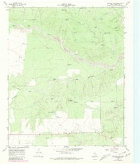
1966 Map of Ballard Camp
USGS Topo · Published 1981About this map
The Middle Pease River carves a broad valley through the ranching country of Motley County, where the 1966 landscape is defined by its water infrastructure. Named camps and small outposts like Ballard Camp and the settlement of Ballard anchor the region, supported by a dense network of specialized livestock watering points. The map meticulously records these features, including the Boxcar Windmill, Section Two Windmill, and Stotts Windmill, alongside several tanks like the Little Bear Creek Tank. In the southern reaches, industrial activity is noted at the Gravel Pits near the modern highway, where a Roadside Park provides a stopping point for travelers crossing the rugged plains between drainage basins. This survey captures the transition of the West Texas landscape from open range to a more structured agricultural system, marked by property boundaries and the vital Tee Pee Creek.
Find a feature on this map
41 named features on this map. Tap any name to fly to it.
Don’t see what you’re looking for? This feature index may not catch every label — zoom into the map to look around manually.
Map Details
Editions of this 1966 Ballard Camp Map
2 editions found
Other maps of this area

1954 · Lubbock
USGS Topo · 1:250,000

1954 · Plainview
USGS Topo · 1:250,000

1958 · Plainview
USGS Topo · 1:250,000

1966 · Fields Canyon
USGS Topo · 1:24,000

1966 · Matador
USGS Topo · 1:24,000

1966 · Ballard Camp
USGS Topo · 1:24,000

1966 · Tee Pee City
USGS Topo · 1:24,000

1967 · Hornica Creek
USGS Topo · 1:24,000

1967 · Turtle Hole Camp
USGS Topo · 1:24,000

1968 · Roaring Springs
USGS Topo · 1:24,000