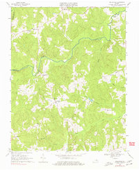
1968 Map of Ballsville
USGS Topo · Published 1977About this map
The Appomattox River winds through the heart of this Piedmont landscape, serving as a natural boundary between Cumberland, Powhatan, and Amelia counties. In the late 1960s, the region retained a distinctly rural character defined by agricultural settlements and small community centers. Clementown Mills sits near the confluence of the Little Bent Creek and the main river, a remnant of the local milling industry that once anchored these watercourses.
Find a feature on this map
25 named features on this map. Tap any name to fly to it.
Don’t see what you’re looking for? This feature index may not catch every label — zoom into the map to look around manually.
Map Details
Editions of this 1968 Ballsville Map
2 editions found
Other maps of this area

1890 · Goochland
USGS Topo · 1:125,000

1891 · Palmyra
USGS Topo · 1:125,000

1891 · Farmville
USGS Topo · 1:125,000

1892 · Goochland
USGS Topo · 1:125,000

1893 · Farmville
USGS Topo · 1:125,000

1895 · Palmyra
USGS Topo · 1:125,000

1897 · Amelia
USGS Topo · 1:125,000

1897 · Palmyra
USGS Topo · 1:125,000

1943 · Powhatan
USGS Topo · 1:31,680

1943 · Amelia
USGS Topo · 1:31,680