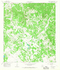
1964 Map of Bandera Pass
USGS Topo · Published 1968About this map
The Bandera Pass gap provides a natural corridor through the limestone ridges of the Texas Hill Country, where the Kerr Co Bandera Co line crosses high terrain. This mid-century survey illustrates a landscape defined by ranching and water management, with numerous wells and gravel pits scattered across the drainages. The Purple Sage Ranch and Montague Lake represent the era's recreational and private land developments, while a network of jeep trails and a remote Landing Strip suggest the limited accessibility of the more isolated elevations.
Find a feature on this map
35 named features on this map. Tap any name to fly to it.
Don’t see what you’re looking for? This feature index may not catch every label — zoom into the map to look around manually.
Map Details
Editions of this 1964 Bandera Pass Map
Other maps of this area

1954 · San Antonio
USGS Topo · 1:250,000

1956 · Comfort
USGS Topo · 1:62,500

1956 · Bandera
USGS Topo · 1:62,500

1956 · Medina Lake
USGS Topo · 1:62,500

1956 · Center Point
USGS Topo · 1:62,500

1957 · San Antonio
USGS Topo · 1:250,000

1964 · Comfort
USGS Topo · 1:24,000

1964 · Center Point
USGS Topo · 1:24,000

1964 · Bandera
USGS Topo · 1:24,000

1964 · Rock Cliff Reservoir
USGS Topo · 1:24,000