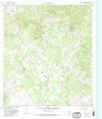
1964 Map of Bandera Pass
USGS Topo · Published 1982About this map
Bandera Pass serves as a historic gateway through the hills along the border of Kerr and Bandera Counties, anchoring a landscape defined by sharp elevation changes and seasonal watercourses. The 1964 survey, with 1982 photorevisions, captures the area during a period of transition where traditional ranching terrain began to accommodate small private airfields and recreation spots. Notable family-named landmarks like Duffys Mtn and Nanny Trap Mtn rise above the drainage of Bandera Creek and Myrtle Creek, while a Landing Field near Montague Lake suggests the increasing accessibility of this Hill Country pocket. To the southeast, the Purple Sage Ranch and the prominence of Polly Peak mark a terrain still largely characterized by unimproved roads and fine fence lines, indicating a rural economy built on large-acreage holdings and livestock management.
Find a feature on this map
30 named features on this map. Tap any name to fly to it.
Don’t see what you’re looking for? This feature index may not catch every label — zoom into the map to look around manually.
Map Details
Editions of this 1964 Bandera Pass Map
Other maps of this area

1954 · San Antonio
USGS Topo · 1:250,000

1956 · Comfort
USGS Topo · 1:62,500

1956 · Bandera
USGS Topo · 1:62,500

1956 · Medina Lake
USGS Topo · 1:62,500

1956 · Center Point
USGS Topo · 1:62,500

1957 · San Antonio
USGS Topo · 1:250,000

1964 · Comfort
USGS Topo · 1:24,000

1964 · Center Point
USGS Topo · 1:24,000

1964 · Bandera
USGS Topo · 1:24,000

1964 · Rock Cliff Reservoir
USGS Topo · 1:24,000