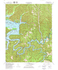
1979 Map of Bangor
USGS Topo · Published 1979About this map
Cave Run Lake dominates the landscape of this 1970s survey, a man-made feature created by the impoundment of the Licking River. The reservoir's reach extends through the heart of the Daniel Boone National Forest, surrounding high points like Wilson Hill and filling once-dry drainage basins. This transformation of the terrain is evident where former river valleys now serve as recreation sites, marked by numerous boat ramps along the convoluted shoreline.
Find a feature on this map
78 named features on this map. Tap any name to fly to it.
Don’t see what you’re looking for? This feature index may not catch every label — zoom into the map to look around manually.
Map Details
Editions of this 1979 Bangor Map
2 editions found
Other maps of this area

1889 · Salyersville
USGS Topo · 1:125,000

1891 · Salyersville
USGS Topo · 1:125,000

1892 · Beattyville
USGS Topo · 1:125,000

1899 · Salyersville
USGS Topo · 1:125,000

1929 · Morehead
USGS Topo · 1:48,000

1929 · Salt Lick
USGS Topo · 1:62,500

1934 · Salt Lick
USGS Topo · 1:62,500

1935 · Morehead
USGS Topo · 1:62,500

1951 · Ezel
USGS Topo · 1:24,000
1951 · West Liberty
USGS Topo · 1:24,000