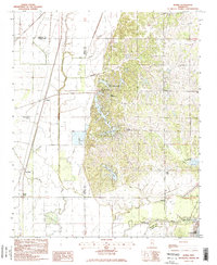
1982 Map of Banks
USGS Topo · Published 1982About this map
The low-lying wetlands of the Mississippi Delta meet the rising bluff line of the Loess Hills in this early 1980s provisional survey. Banks serves as a central reference point in the flat alluvial plain of the west, where intricate drainage systems like Cormorant Bayou and Beaverdam Bayou manage the water levels of the surrounding agricultural land. A notable commercial operation, the Fish Farm, is situated near the center of the sheet, reflecting the local aquaculture economy of the period.
Find a feature on this map
29 named features on this map. Tap any name to fly to it.
Don’t see what you’re looking for? This feature index may not catch every label — zoom into the map to look around manually.
Map Details
Editions of this 1982 Banks Map
2 editions found
Other maps of this area

1908 · Hollywood
USGS Topo · 1:24,000

1908 · Lake Cormorant
USGS Topo · 1:24,000

1912 · Lake Cormorant
USGS Topo · 1:31,680

1913 · Hollywood
USGS Topo · 1:31,680

1931 · Horseshoe Lake
USGS Topo · 1:62,500

1932 · Horn Lake
USGS Topo · 1:48,000

1932 · Crenshaw
USGS Topo · 1:62,500

1935 · Crenshaw
USGS Topo · 1:62,500

1935 · Horn Lake
USGS Topo · 1:62,500

1939 · Clayton
USGS Topo · 1:62,500