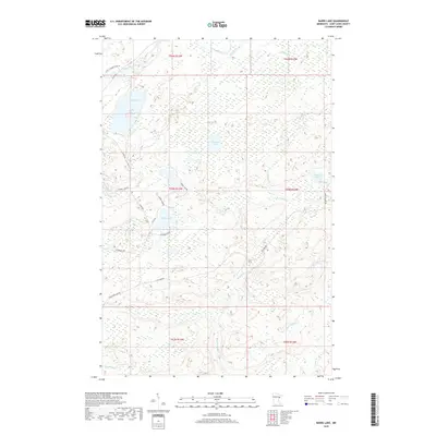
2019 Map of Barrs Lake
USGS Topo · Published 2019About this map
Barrs Lake and the surrounding wilderness of Normanna Township are defined by a complex network of glacial lakes and northern streams. In this 2019 landscape, the Little Cloquet River winds through the northwest while the headwaters of the French River emerge in the south. The area is characterized by isolated bodies of water like Lieuna Lake, Esswhtar Lake, and the small Hart Lake. Local transit is limited to rural routes and forestry paths such as Fox Farm Rd and Pequaywan Lake Rd, which provide access through the dense wetland and timber terrain. This survey captures a region where the natural hydrography, including named tributaries like Captain Jacobson Cr and Big Sucker Cr, continues to dictate the sparse settlement patterns of Saint Louis County.
Find a feature on this map
33 named features on this map. Tap any name to fly to it.
Don’t see what you’re looking for? This feature index may not catch every label — zoom into the map to look around manually.
Map Details
Editions of this 2019 Barrs Lake Map
This is the sole edition of this map. No revisions or reprints were ever made.
Other maps of this area

1895 · Duluth
USGS Topo · 1:62,500

1953 · French River
USGS Topo · 1:24,000

1953 · Arnold
USGS Topo · 1:24,000

1953 · Knife River
USGS Topo · 1:24,000

1953 · Duluth
USGS Topo · 1:62,500

1953 · Ashland
USGS Topo · 1:250,000

1953 · Duluth
USGS Topo · 1:250,000

1954 · Barrs Lake
USGS Topo · 1:24,000

1954 · Thompson Lake
USGS Topo · 1:24,000

1954 · Mc Carthy Creek
USGS Topo · 1:24,000