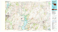
1985 Map of Bartlesville
USGS Topo · Published 1990About this map
Oologah Lake dominates the central landscape of this Northeast Oklahoma region, fed by the southward-flowing Verdigris River. This mid-1980s snapshot of the Osage and Cherokee Nation borders reveals a complex network of industrial and agricultural activity, particularly the extensive Strip Mines located between Nowata and Vinita. The map details the transition from the prairie lands of the west to the water-rich eastern counties, marked by the reservoirs at Copan Lake and the smaller settlements of Ochelata and Ramona.
Find a feature on this map
76 named features on this map. Tap any name to fly to it.
Don’t see what you’re looking for? This feature index may not catch every label — zoom into the map to look around manually.
Map Details
Editions of this 1985 Bartlesville Map
2 editions found
Other maps of this area

1885 · Sedan
USGS Topo · 1:125,000

1886 · Joplin
USGS Topo · 1:125,000

1886 · Independence
USGS Topo · 1:125,000

1886 · Parsons
USGS Topo · 1:125,000

1889 · Sedan
USGS Topo · 1:125,000

1893 · Parsons
USGS Topo · 1:125,000

1894 · Independence
USGS Topo · 1:125,000

1894 · Joplin
USGS Topo · 1:125,000

1896 · Pryor
USGS Topo · 1:125,000

1899 · Siloam Springs
USGS Topo · 1:125,000