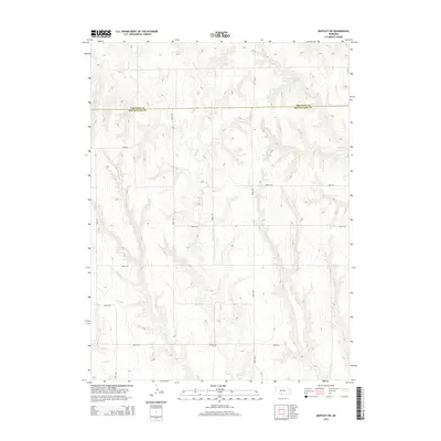
2014 Map of Bartley SW
USGS Topo · Published 2014About this map
The boundary between Frontier Co and Red Willow Co bisects this prairie landscape, where the terrain is defined by a series of drainage systems and artificial water catchments. The area is marked by the presence of Kometcher Reservoir in the northwest, while the eastern portion of the quadrangle contains Dry Cr Reservoir 3-A and Dry Cr Reservoir 3-B. These man-made features highlight the region's managed water resources for agriculture and livestock. The natural drainage is driven by the winding paths of Coon Cr and Wildcat Cr, which cut through the undulating plains. A grid of rural routes, including Road 722 and Road 395, provides a window into the land divisions and remote ranching infrastructure of this part of Nebraska during the early twenty-first century.
Find a feature on this map
15 named features on this map. Tap any name to fly to it.
Don’t see what you’re looking for? This feature index may not catch every label — zoom into the map to look around manually.
Map Details
Editions of this 2014 Bartley SW Map
This is the sole edition of this map. No revisions or reprints were ever made.
Other maps of this area

1954 · McCook
USGS Topo · 1:250,000

1956 · Freedom
USGS Topo · 1:24,000

1956 · Quick NE
USGS Topo · 1:24,000

1956 · Bartley NW
USGS Topo · 1:24,000

1956 · Bartley
USGS Topo · 1:24,000

1957 · McCook
USGS Topo · 1:250,000

1957 · Danbury NE
USGS Topo · 1:24,000

1958 · McCook
USGS Topo · 1:250,000

1958 · Danbury NE
USGS Topo · 1:24,000
1958 · Indianola
USGS Topo · 1:24,000