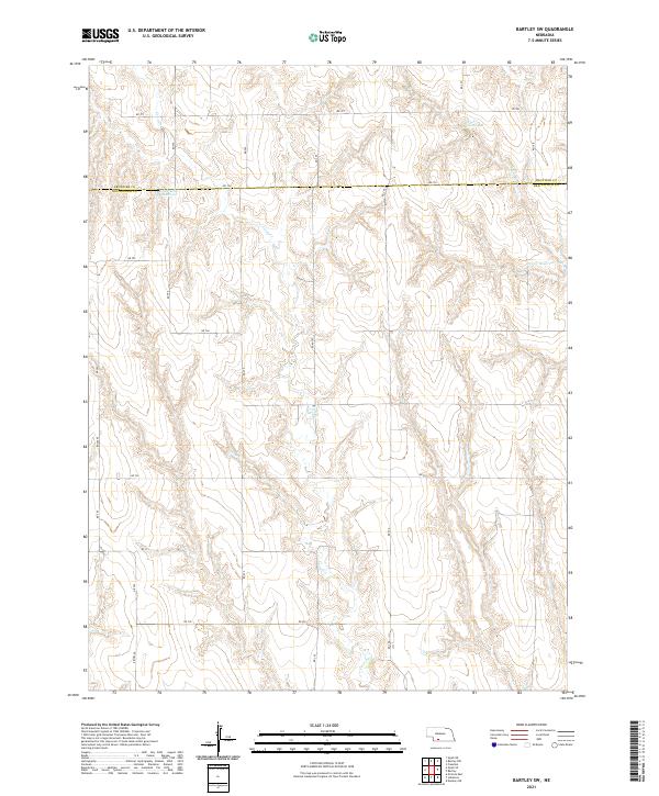
2021 Map of Bartley SW
USGS Topo · Published 2021About this map
The rolling agricultural landscape along the Frontier Co Red Willow Co line is defined by a complex network of intermittent drainages and water management features. Coon Cr and Wildcat Cr carve through the dissected terrain, which is managed by several engineered catchments. Prominent among these are Kometscher Reservoir and the numbered basins Dry Cr Reservoir 3-B and Dry Cr Reservoir 3-A, which illustrate the region's focus on soil conservation and water retention. The section-line road grid, including RD 726 and RD 722, follows the traditional Public Land Survey System layout across Townships 3N, 4N, and 5N. This survey documents the intersection of rural infrastructure and Nebraska's high plains topography during the early twenty-first century.
Find a feature on this map
20 named features on this map. Tap any name to fly to it.
Don’t see what you’re looking for? This feature index may not catch every label — zoom into the map to look around manually.
Map Details
Editions of this 2021 Bartley SW Map
This is the sole edition of this map. No revisions or reprints were ever made.
Other maps of this area

1954 · McCook
USGS Topo · 1:250,000

1956 · Freedom
USGS Topo · 1:24,000

1956 · Quick NE
USGS Topo · 1:24,000

1956 · Bartley NW
USGS Topo · 1:24,000

1956 · Bartley
USGS Topo · 1:24,000

1957 · McCook
USGS Topo · 1:250,000

1957 · Danbury NE
USGS Topo · 1:24,000

1958 · McCook
USGS Topo · 1:250,000

1958 · Danbury NE
USGS Topo · 1:24,000
1958 · Indianola
USGS Topo · 1:24,000