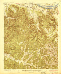
1929 Map of Barton
USGS Topo · Published 1929About this map
The Tennessee River corridor in Northwest Alabama is defined by a dense network of creeks and small rural settlements during the late 1920s. Along the northern edge, the Southern RR provides the primary industrial spine, connecting the communities of Barton and Pride. This area is characterized by many family and local landmarks, including the Barton Cem and numerous country schools such as Zion Sch and Price Sch.
Find a feature on this map
63 named features on this map. Tap any name to fly to it.
Don’t see what you’re looking for? This feature index may not catch every label — zoom into the map to look around manually.
Map Details
Editions of this 1929 Barton Map
3 editions found

Other maps of this area

1911 · Iuka
USGS Topo · 1:48,000

1914 · Iuka
USGS Topo · 1:62,500

1914 · Muscle Shoals
USGS Topo · 1:48,000

1916 · Muscle Shoals
USGS Topo · 1:62,500

1924 · Tuscumbia
USGS Topo · 1:48,000

1924 · Gravelly Springs
USGS Topo · 1:48,000

1925 · Barton
USGS Topo · 1:62,500

1926 · Tuscumbia
USGS Topo · 1:62,500

1926 · Barton
USGS Topo · 1:48,000

1926 · Gravelly Springs
USGS Topo · 1:62,500