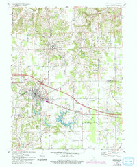
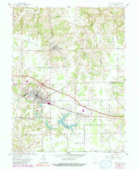
1961 Map of Batesville
USGS Topo · Published 1993About this map
Oldenburg and Batesville anchor this detailed study of the southeastern Indiana landscape, where the Franklin Co Ripley Co line divides the terrain. The Catholic heritage of the region is prominent, marked by the Holy Family Church and the Sorrowful Mother Shrine. To the west, the settlement of Huntersville sits adjacent to the local rail lines, while smaller hamlets like Morris and Spades are connected by a network of rural roads such as 1550 North Road.
Find a feature on this map
47 named features on this map. Tap any name to fly to it.
Don’t see what you’re looking for? This feature index may not catch every label — zoom into the map to look around manually.
Map Details
Editions of this 1961 Batesville Map
5 editions found
Other maps of this area

1946 · Pierceville
USGS Topo · 1:24,000

1946 · Batesville
USGS Topo · 1:24,000

1946 · Osgood
USGS Topo · 1:24,000

1946 · New Point
USGS Topo · 1:24,000

1953 · Cincinnati
USGS Topo · 1:250,000

1956 · Metamora
USGS Topo · 1:24,000

1956 · Brookville
USGS Topo · 1:24,000

1957 · Cincinnati
USGS Topo · 1:250,000

1958 · Spades
USGS Topo · 1:24,000

1958 · Clarksburg
USGS Topo · 1:24,000