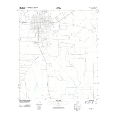
2010 Map of Bay City
USGS Topo · Published 2010About this map
Bay City serves as the focal point of this coastal prairie landscape, its grid-like street pattern bounded to the west by the Colorado River. The town's historical roots are visible through sites like Bay City Cemetery and East End Cemetery, while its agricultural ties are reflected in the presence of the Fehmel Dusting Service Airport. The surrounding terrain is defined by a dense network of meandering waterways, including Bucks Bayou, Cottonwood Creek, and Live Oak Creek, which drain the low-lying fields south and east of the city. These drainage patterns, such as Wadsworth Slough and Peyton Creek, illustrate the hydrological complexity of Matagorda County. The map also traces a network of farm-to-market roads and rural lanes like Old Van Vleck Rd and Show Boat Rd, which connect the urban center to the surrounding agricultural tracts and coastal marshes.
Find a feature on this map
43 named features on this map. Tap any name to fly to it.
Don’t see what you’re looking for? This feature index may not catch every label — zoom into the map to look around manually.
Map Details
Editions of this 2010 Bay City Map
This is the sole edition of this map. No revisions or reprints were ever made.
Other maps of this area

1950 · Houston
USGS Topo · 1:250,000

1951 · Bay City
USGS Topo · 1:250,000

1952 · Ashwood
USGS Topo · 1:24,000

1952 · Lake Austin
USGS Topo · 1:24,000

1952 · Lane City SE
USGS Topo · 1:24,000

1952 · Blessing SE
USGS Topo · 1:24,000

1952 · Bay City
USGS Topo · 1:24,000

1952 · Markham
USGS Topo · 1:24,000

1952 · Bay City NE
USGS Topo · 1:24,000

1952 · Van Vleck
USGS Topo · 1:24,000