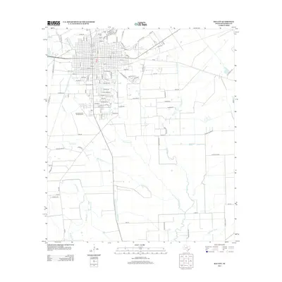
2013 Map of Bay City
USGS Topo · Published 2013About this map
The Colorado River defines the western edge of this coastal prairie landscape, where the street grid of the county seat transitions into a complex network of bayous and sloughs. Genealogical researchers will find significant sites at the Bay City Cem and E End Cem on the northern outskirts of town. The area south of the main settlement is dominated by a drainage pattern that includes the Bucks Bayou, Cottonwood Cr, and Big Boggy Creek, illustrating the low-lying hydrology typical of the Texas Gulf Coast region. Agricultural aviation plays a visible role in the local economy, centered around the Fehmel Dusting Service Airport situated between the river and the southern residential expansion. To the east, the terrain becomes increasingly interlaced with waterways like the Wadsworth Slough and Peyton Cr, showing the rural character of the county beyond the immediate urban center.
Find a feature on this map
113 named features on this map. Tap any name to fly to it.
Don’t see what you’re looking for? This feature index may not catch every label — zoom into the map to look around manually.
Map Details
Editions of this 2013 Bay City Map
This is the sole edition of this map. No revisions or reprints were ever made.
Other maps of this area

1950 · Houston
USGS Topo · 1:250,000

1951 · Bay City
USGS Topo · 1:250,000

1952 · Ashwood
USGS Topo · 1:24,000

1952 · Lake Austin
USGS Topo · 1:24,000

1952 · Lane City SE
USGS Topo · 1:24,000

1952 · Blessing SE
USGS Topo · 1:24,000

1952 · Bay City
USGS Topo · 1:24,000

1952 · Markham
USGS Topo · 1:24,000

1952 · Bay City NE
USGS Topo · 1:24,000

1952 · Van Vleck
USGS Topo · 1:24,000