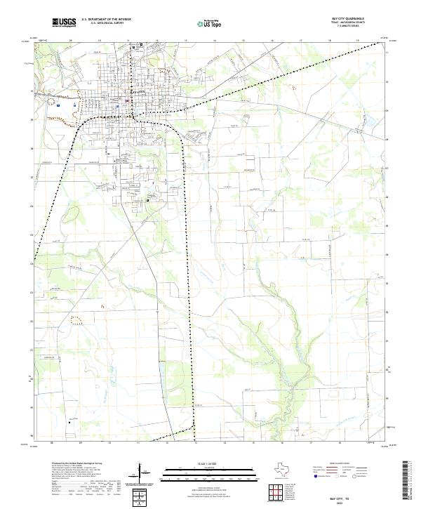
2022 Map of Bay City
USGS Topo · Published 2022About this map
The city of Bay City serves as the focal point of this coastal prairie landscape, anchored by the Matagorda County Courthouse and a grid of streets that extend toward several local burial grounds, including the Eastview Cem and Bay City Cem. Further south, the Wharton County Junior College Bay City Campus marks the edge of the urban development before the terrain transitions into a complex network of waterways. Multiple drainage systems like Live Oak Cr, Bucks Bayou, and Cottonwood Creek weave through the region, eventually feeding into the Wadsworth Slough. For genealogists, the map identifies small, outlying sites such as the Thompson Family Cem and Harris Cem, which provide specific location data for family history research in Matagorda County.
Find a feature on this map
133 named features on this map. Tap any name to fly to it.
Don’t see what you’re looking for? This feature index may not catch every label — zoom into the map to look around manually.
Map Details
Editions of this 2022 Bay City Map
This is the sole edition of this map. No revisions or reprints were ever made.
Other maps of this area

1950 · Houston
USGS Topo · 1:250,000

1951 · Bay City
USGS Topo · 1:250,000

1952 · Ashwood
USGS Topo · 1:24,000

1952 · Lake Austin
USGS Topo · 1:24,000

1952 · Lane City SE
USGS Topo · 1:24,000

1952 · Blessing SE
USGS Topo · 1:24,000

1952 · Bay City
USGS Topo · 1:24,000

1952 · Markham
USGS Topo · 1:24,000

1952 · Bay City NE
USGS Topo · 1:24,000

1952 · Van Vleck
USGS Topo · 1:24,000