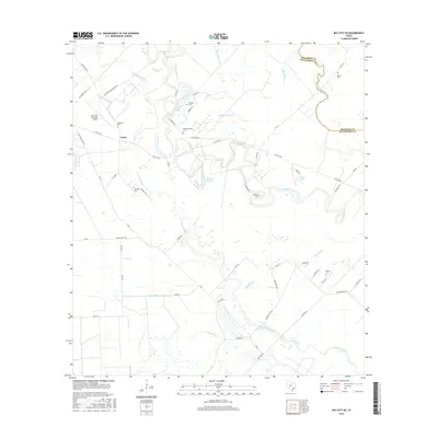
2016 Map of Bay City NE
USGS Topo · Published 2016About this map
Caney sits amidst a complex network of coastal wetlands and waterways on this 2016 survey along the border of Matagorda and Brazoria counties. The landscape is defined by the winding paths of Caney Creek and numerous slow-moving water bodies such as Wildcat Slough, Dead Slough, and Linnville Bayou. For family historians, the area is notable for several small, dispersed burial grounds including Matthews Cem, Hudgins Cem, and Pleasant Green Cem, reflecting the rural settlement patterns of the Texas coastal plain. Infrastructure in the region is anchored by the Bay City Municipal Airport and a grid of secondary roads like FM 457 HWY. The topography reveals the intricate drainage system of the Gulf Coast, where Canoe Bayou and Live Oak Bayou thread through low-lying terrain near Coon Lake and the Hudgins Reservoir.
Find a feature on this map
58 named features on this map. Tap any name to fly to it.
Don’t see what you’re looking for? This feature index may not catch every label — zoom into the map to look around manually.
Map Details
Editions of this 2016 Bay City NE Map
This is the sole edition of this map. No revisions or reprints were ever made.
Other maps of this area

1950 · Houston
USGS Topo · 1:250,000

1951 · Bay City
USGS Topo · 1:250,000

1952 · Sweeny
USGS Topo · 1:24,000

1952 · Ashwood
USGS Topo · 1:24,000

1952 · Lake Austin
USGS Topo · 1:24,000

1952 · Bay City
USGS Topo · 1:24,000

1952 · Bay City NE
USGS Topo · 1:24,000

1952 · Van Vleck
USGS Topo · 1:24,000

1952 · Cedar Lane
USGS Topo · 1:24,000

1952 · Sargent
USGS Topo · 1:24,000