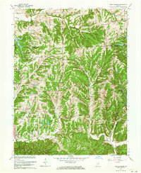
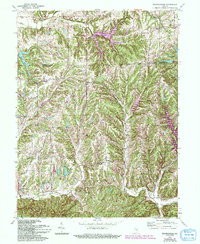
1962 Map of Bean Blossom
USGS Topo · Published 1964About this map
Spearsville and Peoga sit at the northern edge of this landscape, where the deeply dissected topography of Brown Co begins its transition into the flatter lands of Johnson Co. The map reveals a community structured around narrow ridges and winding creek bottoms, with small settlements like Bean Blossom and Gatesville serving as local hubs. The abundance of named hollows, including Pitcher Hollow and Wolfpen Hollow, underscores the intricate drainage system of Bean Blossom Creek and Salt Creek.
Find a feature on this map
43 named features on this map. Tap any name to fly to it.
Don’t see what you’re looking for? This feature index may not catch every label — zoom into the map to look around manually.
Map Details
Editions of this 1962 Bean Blossom Map
5 editions found
Other maps of this area

1942 · Franklin
USGS Topo · 1:125,000

1946 · Belmont
USGS Topo · 1:24,000

1947 · Nashville
USGS Topo · 1:24,000

1947 · Franklin
USGS Topo · 1:62,500

1948 · Franklin
USGS Topo · 1:24,000

1948 · New Bellsville
USGS Topo · 1:24,000

1948 · Trafalgar
USGS Topo · 1:24,000

1948 · Nineveh
USGS Topo · 1:24,000

1948 · Fruitdale
USGS Topo · 1:24,000

1948 · Morgantown
USGS Topo · 1:24,000