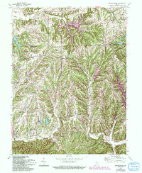
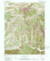
1962 Map of Beanblossom
USGS Topo · Published 1994About this map
Beanblossom sits at the southern edge of this study, marking a landscape where agricultural clearings meet the dense drainage networks of the Hamblen and Nineveh townships. This 1962 survey, updated with revisions through the early 1990s, illustrates the transformation of the region’s hydrology, particularly the emergence of recreation and residential water bodies such as Sweetwater Lake and Cordry Lake in the eastern hills.
Find a feature on this map
36 named features on this map. Tap any name to fly to it.
Don’t see what you’re looking for? This feature index may not catch every label — zoom into the map to look around manually.
Map Details
Editions of this 1962 Beanblossom Map
5 editions found
Other maps of this area

1942 · Franklin
USGS Topo · 1:125,000

1946 · Belmont
USGS Topo · 1:24,000

1947 · Nashville
USGS Topo · 1:24,000

1947 · Franklin
USGS Topo · 1:62,500

1948 · Franklin
USGS Topo · 1:24,000

1948 · New Bellsville
USGS Topo · 1:24,000

1948 · Trafalgar
USGS Topo · 1:24,000

1948 · Nineveh
USGS Topo · 1:24,000

1948 · Fruitdale
USGS Topo · 1:24,000

1948 · Morgantown
USGS Topo · 1:24,000