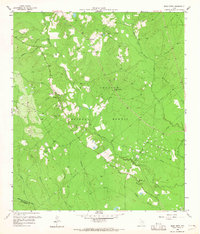
1958 Map of Bear Creek
USGS Topo · Published 1965About this map
The Sam Houston National Forest covers a substantial portion of this landscape at the intersection of San Jacinto and Montgomery Counties. The terrain is defined by a dense network of waterways feeding into the East Fork San Jacinto River and Winters Bayou, including Bear Creek and Jayhawker Creek. Small settlements and community landmarks like Oak Grove and the Purkerson Cem are connected by rural routes such as Hill Store Road. The presence of Mercy Field and various Oil Wells indicates the region's mid-century reliance on petroleum extraction. Local spiritual life is anchored by Magnolia Ch, Pleasant Grove Ch, and Montague Ch, which appear as important social nodes in an area otherwise dominated by timber and oil interests.
Find a feature on this map
34 named features on this map. Tap any name to fly to it.
Don’t see what you’re looking for? This feature index may not catch every label — zoom into the map to look around manually.
Map Details
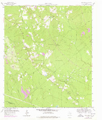
Editions of this 1958 Bear Creek Map
3 editions found
Other maps of this area

1954 · Beaumont
USGS Topo · 1:250,000

1957 · Beaumont
USGS Topo · 1:250,000

1958 · Fostoria
USGS Topo · 1:24,000

1958 · Cleveland
USGS Topo · 1:24,000

1958 · Westcott
USGS Topo · 1:24,000

1958 · Bear Creek
USGS Topo · 1:24,000

1959 · Cut and Shoot
USGS Topo · 1:24,000

1959 · Conroe NE
USGS Topo · 1:24,000

1960 · Maynard
USGS Topo · 1:24,000

1960 · Camilla
USGS Topo · 1:24,000